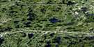
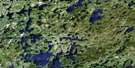
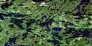
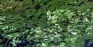
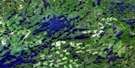
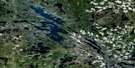
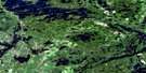
Stormy Lake Satellite Image Map
Download Free Aerial Photo 052F08 at 1:50,000 scale
Stormy Lake Satellite Imagery
To view this satellite map, mouse over the air photo on the right.
You can also download this satellite image map for free:
052F08 Stormy Lake high-resolution satellite image map.
Maps for the Stormy Lake aerial map sheet 052F08 at 1:50,000 scale are also available in these versions:
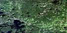
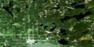
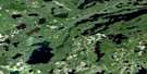
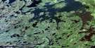
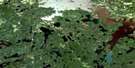
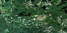
Stormy Lake Surrounding Area Aerial Photo Maps
 |
 |
 |
 |
 |
 |
 |
 |
 |
 |
 |
 |
 |
 |
 |
 |
© Department of Natural Resources Canada. All rights reserved.
Stormy Lake Gazetteer
The following places can be found on satellite image map 052F08 Stormy Lake:
Stormy Lake Satellite Image: Bays
Snake BayStormy Lake Satellite Image: Capes
Sand PointStormy Lake Satellite Image: Geographical areas
HodgsonIlsley
Stormy Lake Satellite Image: Lakes
Aiabewatik LakeBeak Lake
Bending Lake
Church Lake
Cox Lake
Drum Lake
East Revell Lake
Gawjewiagwa Lake
Green Lake
Jake's Lake
Kamanatogama Lake
Katisha Lake
Kawashegamuk Lake
Kawijekiwa Lake
Kinmoapiku Lake
Lee Lake
Little Mennin Lake
Long Lake
Lowery Lake
Mennin Lake
Morey Lake
Namaygoos Lake
Noxheiatik Lake
Oldberg Lake
Osprey Lake
Paddy Lake
Page Lake
Rawlinson Lake
Revell Lake
Sandbar Lake
Seggemak Lake
Shongwashu Lake
Smirch Lake
South Wapageisi Lake
Spear Lake
Spruce Lake
Stormy Lake
The Lake
Three Mile Lake
Wapageisi Lake
Washeibemaga Lake
West Hawk Lake
Stormy Lake Satellite Image: Conservation areas
Stormy Lake Conservation ReserveTurtle River Provincial Park
Turtle River-White Otter Lake Provincial Park
Stormy Lake Satellite Image: Rivers
Bending CreekKatisha Creek
Kawashegamuk River
Long Lake River
Mennin River
Rawlinson Creek
Revell River
Turtle River
Wapageisi River

© Department of Natural Resources Canada. All rights reserved.
052F Related Maps:
052F Dryden052F01 Pekagoning Lake
052F02 Entwine Lake
052F03 Harris Lake
052F04 Kakagi Lake
052F05 Caviar Lake
052F06 Lawrence Lake
052F07 Upper Manitou Lake
052F08 Stormy Lake
052F09 Dyment
052F10 Wabigoon
052F11 Osbourne Bay
052F12 Dryberry Lake
052F13 Feist Lake
052F14 Vermilion Bay
052F15 Dryden
052F16 Big Sandy Lake
