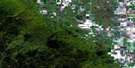
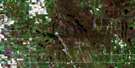
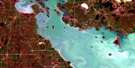
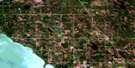
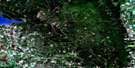
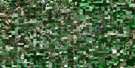
Arden Satellite Image Map
Download Free Aerial Photo 062J06 at 1:50,000 scale
Arden Satellite Imagery
To view this satellite map, mouse over the air photo on the right.
You can also download this satellite image map for free:
062J06 Arden high-resolution satellite image map.
Maps for the Arden aerial map sheet 062J06 at 1:50,000 scale are also available in these versions:
Arden Surrounding Area Aerial Photo Maps
 |
 |
 |
 |
 |
 |
 |
 |
 |
 |
 |
 |
 |
 |
 |
 |
© Department of Natural Resources Canada. All rights reserved.
Arden Gazetteer
The following places can be found on satellite image map 062J06 Arden:
Arden Satellite Image: Hydraulic construction
Jordan Creek DrainJumping Deer Drain
Pembroke Drain
Arden Satellite Image: Lakes
Love LakeRoes Lake
Arden Satellite Image: Mountains
Arden RidgeRobins Ridge
Arden Satellite Image: Other municipal/district area - miscellaneous
LansdowneRosedale
Westbourne
Arden Satellite Image: Conservation areas
Whitemud Watershed Wildlife Management AreaArden Satellite Image: Rivers
Birnie CreekEden Creek
Jumping Deer Creek
Law Creek
Millar Creek
Miller Creek
Mink Creek
North Snake Creek
Pelican Creek
Snake Creek
Spring Creek
Wapus Creek
Whitemud River
Whitemud River
Arden Satellite Image: Road features
Parks RouteRoute des parcs
Arden Satellite Image: Unincorporated areas
ArdenBirnie
Colby
Eden
Howden
Ogilvie
Ogilvie Station
Plumas
Rossburn Junction
Tenby
Arden Satellite Image: Valleys
Shale ValleyArden Satellite Image: Low vegetation
Boughtons SloughCymbalist Slough

© Department of Natural Resources Canada. All rights reserved.
