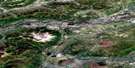
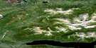
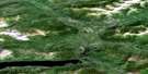
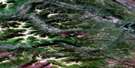
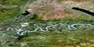
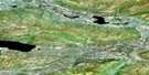
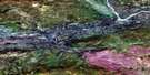
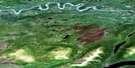
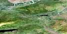
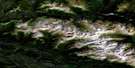
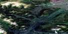
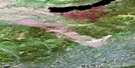
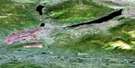
Keno Hill Satellite Image Map
Download Free Aerial Photo 105M14 at 1:50,000 scale
Keno Hill Satellite Imagery
To view this satellite map, mouse over the air photo on the right.
You can also download this satellite image map for free:
105M14 Keno Hill high-resolution satellite image map.
Maps for the Keno Hill aerial map sheet 105M14 at 1:50,000 scale are also available in these versions:
Keno Hill Surrounding Area Aerial Photo Maps
 |
 |
 |
 |
 |
 |
 |
 |
 |
 |
 |
 |
 |
 |
 |
 |
© Department of Natural Resources Canada. All rights reserved.
Keno Hill Gazetteer
The following places can be found on satellite image map 105M14 Keno Hill:
Keno Hill Satellite Image: Lakes
Christal LakeGambler Lake
Hanson Lake
Hanson Lakes
Ladue Lake
Mayo Lake
Keno Hill Satellite Image: Mountains
Beauvette HillBunker Hill
Caribou Hill
Galena Hill
Gustavus Mountains
Gustavus Range
Keno Hill
Keno Hill
Keno Summit
Minto Hill
Monument Hill
Mount Albert
Mount Beliveau
Mount Berry
Mount Hinton
Sourdough Hill
Keno Hill Satellite Image: Plains
Yukon PlateauKeno Hill Satellite Image: Rivers
Allen CreekBarney Creek
Beliveau Creek
Brefalt Creek
Christal Creek
Davidson Creek
Duncan Creek
Faith Creek
Fisher Creek
Flat Creek
Forty Pup
Granite Creek
Kelly Creek
Keno Ladue River
Keystone Creek
Ladue Creek
Ladue River
Lightning Creek
Mayo Brook
Mayo River
McKim Creek
McLeod Creek
Owl Creek
Parent Creek
Pingpong Creek
Sandy Creek
South McQuesten River
Star Creek
Williams Creek
Zone Creek
Keno Hill Satellite Image: Unincorporated areas
CalumetElsa
Keno Hill
Wernecke
Keno Hill Satellite Image: Valleys
Charity GulchDawn Gulch
Erickson Gulch
Faro Gulch
Gambler Gulch
Hope Gulch
McKay Gulch
McMillan Gulch
McNeill Gulch
Porcupine Gulch
Silver Basin Gulch
Thunder Gulch

© Department of Natural Resources Canada. All rights reserved.
105M Related Maps:
105M Mayo105M01 Moose Lake
105M02 Clarke Hills
105M03 Sideslip Lake
105M04 Woodburn Lake
105M05 Francis Lake
105M06 Nogold Creek
105M07 Highland Lake
105M08 Canoe Creek
105M09 Edwards Lake
105M10 South Nelson Creek
105M11 Williamson Lake
105M12 Mayo
105M13 Mount Haldane
105M14 Keno Hill
105M15 Mayo Lake
105M16 Tiny Island Lake
