St Thomas Topo Map Online
Download Free Topo Map Sheet 040I14 at 1:50,000 scale
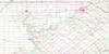
040I14 St Thomas Topo Map
To view this map, mouse over the map preview on the right.
You can also download this topo map for free:
040I14 St Thomas high-resolution topo map image.
Maps for the St Thomas topo map sheet 040I14 at 1:50,000 scale are also available in these versions:
St Thomas Surrounding Area Topo Maps
 |
 |
 |
 |
 |
 |
 |
 |
 |
|||
© Department of Natural Resources Canada. All rights reserved.
St Thomas Gazetteer
The following places can be found on topographic map sheet 040I14 St Thomas:
St Thomas Topo Map: City
LondonSt. Thomas
St Thomas Topo Map: Geographical areas
CaradocDelaware
Dorchester
Dunwich
Ekfrid
Elgin
Lobo
London
Malahide
Middlesex
North Dorchester
South Dorchester
Southwold
Westminster
Yarmouth
St Thomas Topo Map: Hydraulic construction
Ashton DrainCaddy-Bott Drain
Hawes Drain
Jenkins Drain
St Thomas Topo Map: Indian Reserves
Caradoc Indian Reserve 42Chippewas of the Thames First Nation 42
Chippewas of the Thames First Nation Indian Reserve 42
Muncey Indian Reserve 1
Munsee-Delaware Nation 1
Munsee-Delaware Nation Indian Reserve 1
Oneida 41
Oneida Indian Reserve 41
Réserve indienne Caradoc 42
Réserve indienne Chippewas of the Thames First Nation 42
Réserve indienne Muncey 1
Réserve indienne Munsee-Delaware Nation 1
Réserve indienne Oneida 41
St Thomas Topo Map: Lakes
Beattie PondDingman Lakes
Foster Ponds
Mill Pond
Mud Lakes
Pinafore Lake
Pond Mills
Spettigues Pond
Tennants Pond
The Cove
Tumblesons Pond
Walker Ponds
Walkers Pond
Westminster Ponds
St Thomas Topo Map: Mountains
Pike's PeakSt Thomas Topo Map: Major municipal/district area - major agglomerations
ElginMiddlesex
St Thomas Topo Map: Other municipal/district area - miscellaneous
CaradocCentral Elgin
Central Elgin
Delaware
Dorchester
Dorchester
Dunwich
Dutton/Dunwich
Ekfrid
Lobo
London
Malahide
Middlesex Centre
Mosa
Nissouri
North Dorchester
South Dorchester
Southwest Middlesex
Southwold
Southwold
Strathroy-Caradoc
Thames Centre
West Nissouri
Yarmouth
St Thomas Topo Map: Conservation areas
Komoka Provincial ParkSpringwater Conservation Area
St Thomas Topo Map: Rivers
Baird CreekBradley Creek
Bradleys Creek
Caddy Creek
Catfish Creek
Dawson Creek
Dingman Creek
Dodd Creek
East Catfish Creek
Gold Creek
Hogg Creek
Kettle Creek
Nineteen Creek
North Thames River
Oxbow Creek
Pottersburg Creek
Rivière Thames
Salt Creek
Sharon Creek
Spring Creek
Springers Creek
Thames River
Turkey Creek
Waubuno Creek
West Catfish Creek
St Thomas Topo Map: Towns
WestminsterWestminster
Westminster
Westminster
St Thomas Topo Map: Unincorporated areas
BairdsBelmont
Berkshire Village
Brockley
Byron
Chelsea Green
Christina
Cleardale
Crossley Hunter
Delaware
Delaware West
Derwent
Dorchester
Fairmont
Frome
Gladstone
Glanworth
Glen Cairn Woods
Glendale
Harrietsville
Harrietsville Station
Hubrey
Hyde Park
Hyde Park
Hyde Park Corner
Hyde Park Crossing
Kensal Park
Kensall Park
Kilworth
Kilworth Bridge
Kingsmill
Komoka
Komoka Station
Lambeth
Lawrence Station
Littlewood
Lobo
Lobo Siding
Lockwood Park
Lyndale
Lynhurst
Manor Park
Mapleton
Melrose
Middlemarch
Middlemiss
Mossley
Mount Brydges
Muncey
Nelson Park
New Sarum
Nilestown
Oakridge Acres
Oakridge Park
O'Dell
Orchard Park
Orwell
Oxford Park
Paynes
Paynes Mills
Pond Mills
Pottersburg
Scottsville
Sharon
Southcrest Estates
Southdale
Southwold
Talbotville Royal
Tempo
Thames River Siding
The Gore
Trafalgar Heights
University Heights
Westminster
Westmount
White Oak
Wilton Grove
Woodbank
Yarmouth Centre
St Thomas Topo Map: Low vegetation
Dorchester Swamp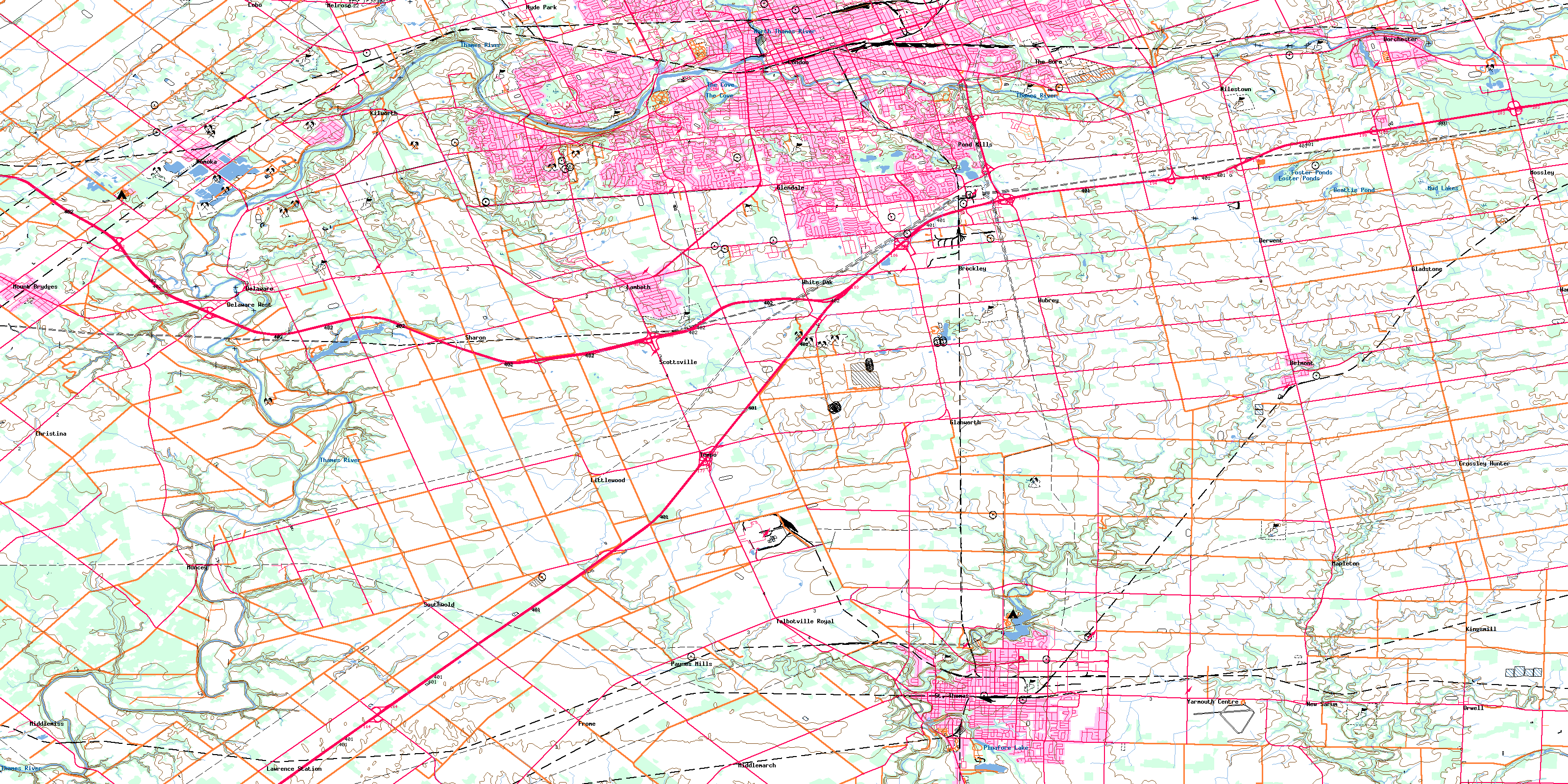
© Department of Natural Resources Canada. All rights reserved.
