Simcoe Topo Map Online
Download Free Topo Map Sheet 040I16 at 1:50,000 scale
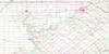
040I16 Simcoe Topo Map
To view this map, mouse over the map preview on the right.
You can also download this topo map for free:
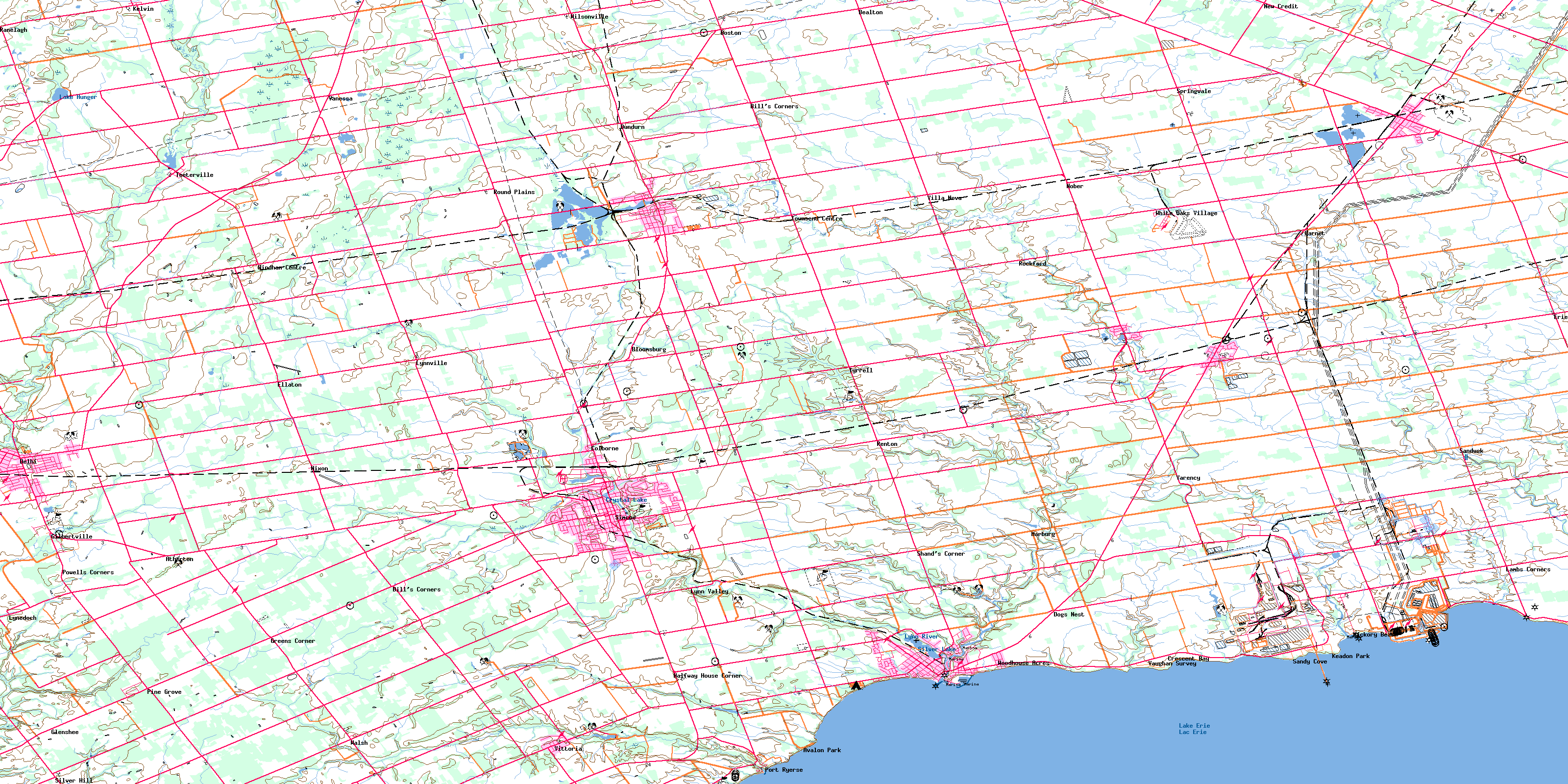
040I16 Simcoe high-resolution topo map image.
Maps for the Simcoe topo map sheet 040I16 at 1:50,000 scale are also available in these versions:
Simcoe Surrounding Area Topo Maps
 |
 |
 |
 |
 |
 |
 |
 |
 |
|||
© Department of Natural Resources Canada. All rights reserved.
Simcoe Gazetteer
The following places can be found on topographic map sheet 040I16 Simcoe:
Simcoe Topo Map: Bays
Long Point BayNanticoke Harbour
Simcoe Topo Map: Capes
Coleman's PointKitchen's Point
Woolley's Point
Simcoe Topo Map: City
BrantBrant-on-the-Grand
Haldimand
Haldimand County
Nanticoke
Nanticoke
Norfolk
Norfolk County
Simcoe Topo Map: Geographical areas
BrantBurford
Charlotteville
Delhi
Haldimand
Middleton
Norfolk
North Cayuga
North Walsingham
Oneida
Oxford
Oxford
South Cayuga
South Walsingham
Townsend
Tuscarora
Walpole
Walsingham
Windham
Woodhouse
Simcoe Topo Map: Hydraulic construction
Harrop DrainSimcoe Topo Map: Indian Reserves
New Credit 40ANew Credit Indian Reserve 40A
Réserve indienne New Credit 40A
Réserve indienne Six Nations 40
Six Nations Indian Reserve 40
Simcoe Topo Map: Islands
Goosey IslandSimcoe Topo Map: Lakes
Crystal LakeLac Érié
Lake Erie
Lake Hunger
Mill Pond
Silver Lake
Sutton's Pond
Waterford Pond
Waterford Ponds
Simcoe Topo Map: Major municipal/district area - major agglomerations
BrantHaldimand
Haldimand-Norfolk
Norfolk
Oxford
Simcoe Topo Map: Other municipal/district area - miscellaneous
BrantfordBurford
Canborough
Charlotteville
Delhi
Dumfries
Dunn
Houghton
Middleton
Moulton
Norfolk
North Cayuga
North Walsingham
Oakland
Oneida
Onondaga
Rainham
Seneca
Sherbrooke
South Cayuga
South Dumfries
South Walsingham
Townsend
Walpole
Walsingham
Windham
Woodhouse
Simcoe Topo Map: Conservation areas
Norfolk Conservation AreaSimcoe Topo Map: Rivers
Big CreekBlack Creek
Boston Creek
Brandy Creek
Catfish Creek
Davis Creek
Dedrick's Creek
Dingle Creek
Dry Creek
Faurie's Creek
Hay Creek
Hickory Creek
Kent Creek
Lynn River
Lynn River
Mud Creek
Nanticoke Creek
Patterson Creek
Rogers Creek
Sandusk Creek
Spring Creek
Spring Creek
Stoney Creek
Stony Creek
Trout Creek
Young Creek
Young's Creek
Simcoe Topo Map: Towns
DunnvilleHaldimand
Simcoe Topo Map: Unincorporated areas
AthertonAvalon Park
Bealton
Bill's Corners
Bill's Corners
Blayney
Bloomsburg
Boston
Brandy Creek
Colborne
Crescent Bay
Delhi
Dogs Nest
Dundern
Dundurn
Ellaton
Erie
Garnet
Gilbertville
Glenshee
Greens Corner
Hagersville
Halfway Corner
Halfway House Corner
Hickory Beach
Hillcrest
Jarvis
Keadon Park
Kelvin
La Salette
Lambs Corners
Lutesville
Lynedoch
Lynn Valley
Lynnville
Marburg
Marr's Hollow
Nanticoke
New Credit
Nixon
Nober
Oneida
Pine Grove
Port Dover
Port Ryerse
Powells Corners
Ranelagh
Rattlesnake Harbour
Renton
Rockford
Round Plains
Sandusk
Sandy Cove
Shand Corner
Shands Corner
Shand's Corner
Silver Hill
Simcoe
Simcoe Junction
Springvale
Sprucedale
Teeterville
Townsend
Townsend Centre
Tyrrell
Vanessa
Vanessa Station
Varency
Vaughan Survey
Villa Nova
Vittoria
Walsh
Waterford
White Oaks Village
Wilsonville
Windham
Windham Centre
Woodhouse Acres
Simcoe Topo Map: Valleys
Doan's HollowMarr's Hollow
© Department of Natural Resources Canada. All rights reserved.
