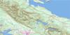
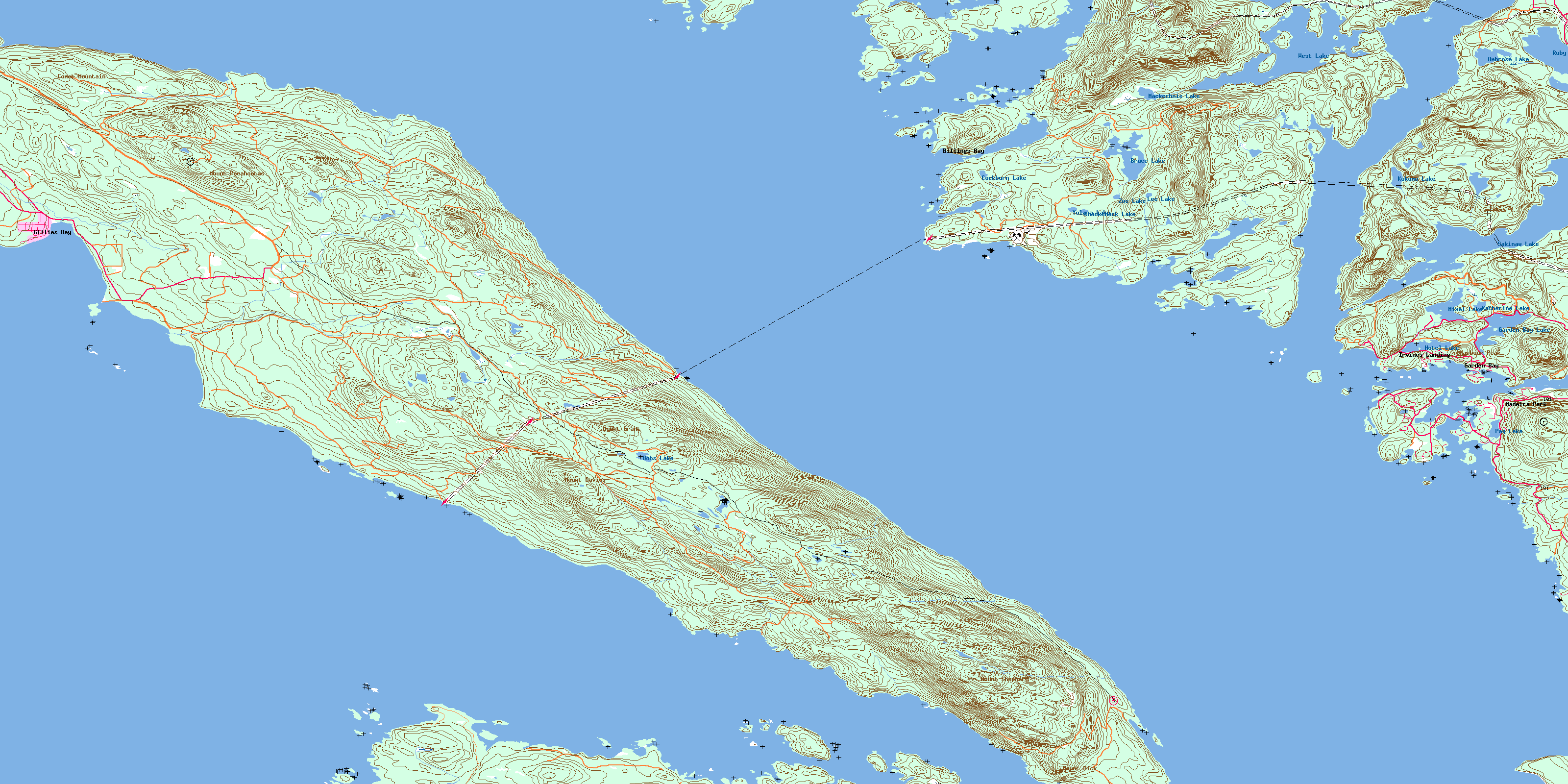
Texada Island Topo Map Online
Download Free Topo Map Sheet 092F09 at 1:50,000 scale
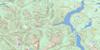
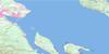
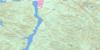
092F09 Texada Island Topo Map
To view this map, mouse over the map preview on the right.
You can also download this topo map for free:
092F09 Texada Island high-resolution topo map image.
Maps for the Texada Island topo map sheet 092F09 at 1:50,000 scale are also available in these versions:
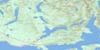
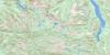
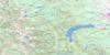
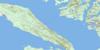
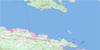
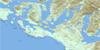
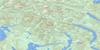
Texada Island Surrounding Area Topo Maps
 |
 |
 |
 |
 |
 |
 |
 |
 |
 |
 |
 |
 |
 |
 |
 |
© Department of Natural Resources Canada. All rights reserved.
Texada Island Gazetteer
The following places can be found on topographic map sheet 092F09 Texada Island:
Texada Island Topo Map: Bays
Anderson BayBallet Bay
Bargain Bay
Bargain Harbour
Bill Bay
Billings Bay
Blind Bay
Cockburn Bay
Cook Bay
Davie Bay
Deep Bay
Dingman Bay
Duncan Cove
False Bay
Farrington Cove
Flat Rock Bay
Francis Bay
Garden Bay
Gerrans Bay
Gillies Bay
Green Bay
Gunboat Bay
Hidden Basin
Hospital Bay
Jervis Inlet
Joe Bay
Lee Bay
Log Boom Cove
Martin Cove
McRae Cove
Mouat Bay
Northeast Bay
Orchard Bay
Pender Harbour
Pocahontas Bay
Quarry Bay
Raven Bay
Scottie Bay
Skerry Bay
Spring Bay
Tucker Bay
Vanguard Bay
Welbourn Cove
Whiskey Cove
Texada Island Topo Map: Capes
Alexander PointCape Cockburn
Daniel Point
Epsom Point
Evenden Point
Fearney Point
Francis Peninsula
Francis Point
Garden Peninsula
Harwood Point
Henry Point
Maynard Head
McNaughton Point
Mermaid Point
Moore Point
Northeast Point
Partington Point
Potter Point
Scotch Fir Point
Sechelt Peninsula
Seechelt Peninsula
Wells Point
West Point
Texada Island Topo Map: Caves
Spanish CaveTexada Island Topo Map: Channels
Agamemnon ChannelBargain Narrows
Bull Passage
Malaspina Strait
Sabine Channel
Stevens Passage
Strait of Georgia
Telescope Passage
The Gap
Texada Island Topo Map: Geographical areas
Nanaimo Land DistrictNew Westminster Land District
Texada Island Land District
Texada Island Topo Map: Indian Reserves
Bargain Harbour Indian Reserve 24Réserve indienne Bargain Harbour 24
Réserve indienne Sallahlus 20
Réserve indienne Sallahlus 20A
Réserve indienne Saughanaught 22
Réserve indienne Sekaleton 21
Réserve indienne Sekaleton 21A
Réserve indienne Suahbin 19
Réserve indienneSawquamain 19A
Sallahlus Indian Reserve 20
Sallahlus Indian Reserve 20A
Saughanaught Indian Reserve 22
Sawquamain Indian Reserve 19A
Sekaleton Indian Reserve 21
Sekaleton Indian Reserve 21A
Suahbin Indian Reserve 19
Texada Island Topo Map: Islands
Ada IslandBeaver Island
Berge Islet
Bishop Islet
Boho Island
Bunny Island
Calder Island
Caldwell Island
Carlsen Islet
Charles Island
Clio Island
Dick Island
Dusenbury Island
Edgecombe Island
Fegan Islets
Fegen Islets
Finnerty Islands
Fisher Island
Fox Island
Goat Islet
Hardy Island
Harness Island
Hodgson Islands
Jedediah Island
Jedidiah Island
Jelina Island
JervisIsland
Kelly Island
Larson Islet
Lasqueti Island
Lindbergh Island
Marr Island
Martin Island
Mary Island
Mary Islet
McRae Islet
Mouat Islands
Nelson Island
Nocturne Island
North Thormanby Island
Oyster Island
Paul Island
Pearson Island
Routh Islet
Sims Islet
Skardon Islands
Strawberry Islet
Texada Island
Thormanby Islands
Watt Islet
Whitestone Island
Whitestone Islands
Williams Island
Texada Island Topo Map: Lakes
Ambrose LakeBobs Lake
Bruce Lake
Chackchack Lake
Cockburn Lake
Cranby Lake
Garden Bay Lake
Hotel Lake
Katherine Lake
Kokomo Lake
Lee Lake
Lily Lake
Little Quarry Lake
Mackechnie Lake
Mixal Lake
Paq Lake
Quarry Lake
Ruby Lake
Sakinaw Lake
West Lake
Whiskey Slough
Yolana Lake
Zoe Lake
Texada Island Topo Map: Mountains
Cecil HillComet Mountain
Harbour Peak
Mount Daniel
Mount Davies
Mount Dick
Mount Grant
Mount Pocahontas
Mount Shepherd
Pender Hill
Texada Island Topo Map: Other municipal/district area - miscellaneous
Bargain Harbour SB 24Sallahlus SB 20
Sallahlus SB 20A
Saughanaught SB 22
Sawquamain SB 19A
Sekaleton SB 21
Sekaleton SB 21A
Suahbin SB 19
Texada Island Topo Map: Conservation areas
Anderson Bay ParkFrancis Point Park
Garden Bay Marine Park
Musket Island Marine Park
Sabine Channel Marine Park
South Texada Island Park
Texada Island Topo Map: Rivers
Bruce CreekCook Creek
Cranby Creek
Egmont Creek
Haslam Creek
Mouat Creek
Napier Creek
Paq Creek
Rumbottle Creek
Russ Creek
Silversands Creek
Staaf Creek
Whiskey Still Creek
Texada Island Topo Map: Shoals
Achilles BankAcland Rock
Avery Reef
Bjerre Shoal
Griffin Ledge
Jacob Rock
Nares Rock
Nelson Rock
Neville Rock
Sinclair Bank
Temple Rock
Tuck Rock
Western Rock
Texada Island Topo Map: Unincorporated areas
Billings BayDonnely Landing
Garden Bay
Gillies Bay
Irvines Landing
Irvine's Landing
Madeira Park
Pender Harbour
Pope Landing
Sechelt Indian Government District
© Department of Natural Resources Canada. All rights reserved.
092F Related Maps:
092F Port Alberni092F01 Nanaimo Lakes
092F02 Alberni Inlet
092F03 Effingham River
092F04 Tofino
092F05 Bedwell River
092F06 Great Central Lake
092F07 Horne Lake
092F08 Parksville
092F09 Texada Island
092F10 Comox
092F11 Forbidden Plateau
092F12 Buttle Lake
092F13 Upper Campbell Lake
092F14 Oyster River
092F15 Powell River
092F16 Haslam Lake
