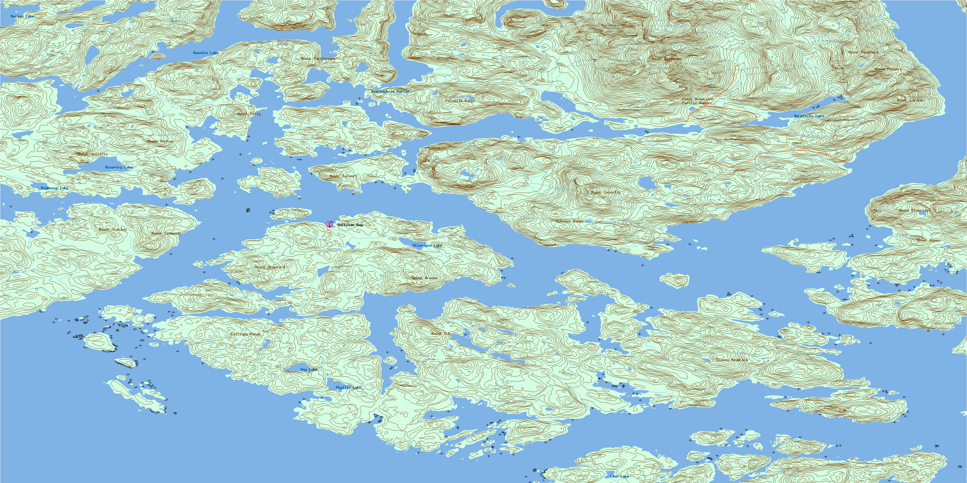
Broughton Island Topo Map Online
Download Free Topo Map Sheet 092L15 at 1:50,000 scale
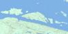
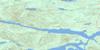
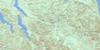
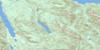
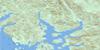
092L15 Broughton Island Topo Map
To view this map, mouse over the map preview on the right.
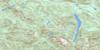
You can also download this topo map for free:
092L15 Broughton Island high-resolution topo map image.
Maps for the Broughton Island topo map sheet 092L15 at 1:50,000 scale are also available in these versions:
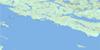
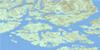
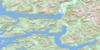
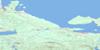
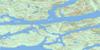
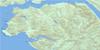
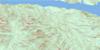
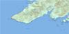
Broughton Island Surrounding Area Topo Maps
 |
 |
 |
 |
 |
 |
 |
 |
 |
 |
 |
 |
 |
 |
 |
 |
© Department of Natural Resources Canada. All rights reserved.
Broughton Island Gazetteer
The following places can be found on topographic map sheet 092L15 Broughton Island:
Broughton Island Topo Map: Bays
Aimee BayBerry Cove
Bughouse Bay
Burly Bay
Carriden Bay
Cartwright Bay
Claydon Bay
Cockatrice Bay
Cullen Harbour
Cypress Harbour
Deep Harbour
Dobbin Bay
Drury Inlet
Duck Inlet
Ellen Cove
Frederick Sound
Freshwater Cove
Harry Bay
Hayle Bay
Helen Bay
Hoy Bay
Joe Cove
Kingcome Inlet
Laura Bay
Little Nimmo Bay
McIntosh Bay
McKenzie Cove
Miller Bay
Moore Bay
Napier Bay
Nimmo Bay
O'Brien Bay
Overflow Basin
Ralph Bay
Reid Bay
Restless Bay
Richmond Bay
Shawl Bay
Sir Edmund Bay
Smith Bay
Steamboat Bay
Stopford Bay
Sullivan Bay
Tancred Bay
Tee Bay
Tracey Harbour
Turnbull Cove
Wehlis Bay
Wolf Cove
Woods Bay
Yuki Bay
Broughton Island Topo Map: Capes
Alder PointAnne Point
Arthur Point
Baronet Point
Bath Point
Blount Point
Bold Point
Bourmaster Point
Boyer Point
Bradley Point
Broughton Point
Burt Point
Cane Point
Card Point
Cardale Head
Carter Point
Cartwright Point
Cawston Point
Claypole Point
Codrington Point
Compton Point
Connolly Point
Cumming Point
Cunning Point
Curtis Point
Donald Head
Duff Point
Ellen Point
Fantome Point
Gawler Point
George Point
Gordon Point
Greenway Point
Griffiths Point
Hannant Point
Harbour Point
Hayes Point
Hayle Point
Hopetown Point
Horsford Point
James Point
Jessie Point
Kenneth Point
Linlithgow Point
Moore Point
Morton Point
Nimmo Point
Notice Point
Olivia Point
Pandora Head
Pearse Peninsula
Pemberton Point
Philip Point
Pollard Point
Popplewell Point
Preston Point
Providence Point
Roffey Point
Sharp Point
Sir Edmund Head
Steep Point
Stirling Point
Sullivan Point
Talbot Point
Upton Point
Vigis Point
Village Point
Walker Point
Watson Point
Wicklow Point
Wishart Peninsula
Wolf Point
Wood Point
Woods Point
Broughton Island Topo Map: Channels
Booker PassageCarter Passage
Cramer Passage
Dunsany Passage
Fife Sound
Grappler Sound
Greenway Sound
Hopetown Passage
Indian Passage
Kenneth Passage
Mackenzie Sound
Nowell Channel
Old Passage
Pasley Passage
Patrick Passage
Penphrase Passage
Queen Charlotte Strait
Raleigh Passage
Sharp Passage
Simoom Sound
Stuart Narrows
Sutlej Channel
Wakeman Sound
Wells Passage
Broughton Island Topo Map: Cliffs
Deep Sea BluffThomas Bluff
Broughton Island Topo Map: Indian Reserves
Hopetown Indian Reserve 10AKadis Indian Reserve 11
Kawages Indian Reserve 4
Keogh Indian Reserve 3
Kukwapa Indian Reserve 5
Kunstamis Indian Reserve 2
Kunstamis Indian Reserve 2A
Lawanth Indian Reserve 5
Magwekstala Indian Reserve 10
Quay Indian Reserve 4
Réserve indienne Hopetown 10A
Réserve indienne Kadis 11
Réserve indienne Kawages 4
Réserve indienne Keogh 3
Réserve indienne Kukwapa 5
Réserve indienne Kunstamis 2
Réserve indienne Kunstamis 2A
Réserve indienne Lawanth 5
Réserve indienne Magwekstala 10
Réserve indienne Quay 4
Broughton Island Topo Map: Islands
Atkinson IslandBaker Island
Benjamin Group
Bermingham Island
Blair Islet
Broughton Archipelago
Broughton Island
Buckingham Island
Cecil Island
Davidson Islet
Davies Island
Denham Island
Dickson Island
Drew Island
Drew Islet
Duff Island
Duff Islet
Eden Island
Fly Island
Gregory Island
Insect Island
John Island
Jumper Island
Keating Islet
Kinnaird Island
Lambert Island
Leche Islet
Ligar Island
Ligar Islet
Long Island
Magin Islands
Magin Islets
Maude Island
Maude Islet
Mauve Island
Mauve Islet
Morris Islet
Nelly Islet
Nicholls Island
Nickless Island
Nickless Islet
Nimmo Islet
North Broughton Island
Olden Island
Ommaney Islet
Percy Island
Polkinghorne Islands
Ragged Island
Rees Island
Screen Island
Simpson Island
Stackhouse Island
Surgeon Islands
Surgeon Islets
Thief Island
Tree Island
Tree Islet
Trivett Island
Turner Island
Vincent Island
Watson Island
Broughton Island Topo Map: Lakes
Allardyce LakeBooker Lagoon
Broughton Lagoon
Broughton Lake
Buckingham Lake
Bughouse Lake
Eden Lake
Embley Lagoon
Huaskin Lake
Mackenzie Lake
Marion Lake
Martin Lake
May Lake
Nepah Lagoon
Phyllis Lake
Rosemary Lake
Twin Lagoon
Broughton Island Topo Map: Marine navigation features
Simoom SoundBroughton Island Topo Map: Mountains
Burnaby RangeBushby Hills
Calliope Range
Catherine Hill
Catherine Mountain
Chaîne Côtière
Cliff Mountain
Coast Mountains
Colville Range
Despard Cone
Double Hill
Elizabeth Cone
Lane Hill
Martin Peak
Matthew Range
Melbourne Hill
Mount Ashe
Mount Beckford
Mount Browne
Mount Burrell
Mount Calvert
Mount Connolly
Mount Eliza
Mount Emily
Mount Fermanagh
Mount Florence
Mount Hawes
Mount Hulme
Mount Ick
Mount Jolliffe
Mount Lardner
Mount Morton
Mount Nightingale
Mount Oke
Mount Otway
Mount Parthenope
Mount Pasmore
Mount Plumridge
Mount Simmonds
Mount Stanley
Mount Stephens
Mount Stopford
Mount Thornton Bate
Ottway Hill
Pacific Ranges
Robert Hills
Sir Harry Range
Stoney Mountain
Walkem Cone
Wren Hills
Broughton Island Topo Map: Major municipal/district area - major agglomerations
Regional District of Mount WaddingtonBroughton Island Topo Map: Rapids
Roaringhole RapidsBroughton Island Topo Map: Rivers
Allardyce CreekDuck Creek
Embley Creek
Broughton Island Topo Map: Shoals
Baxter ShoalBen Rock
Brig Rock
Fife Rock
Fox Rock
Gore Rock
Gull Rock
Keating Rock
Kinnaird Rock
Notice Rock
Nowell Bank
Pasley Rock
Pym Rock
Pym Rocks
Sharp Shoal
Star Rock
Thief Rocks
Trivett Rock
Voak Rock
Welde Rock
Broughton Island Topo Map: Unincorporated areas
HopetownO'Brian Bay
Shawl Bay
Sullivan Bay
© Department of Natural Resources Canada. All rights reserved.
092L Related Maps:
092L Alert Bay092L01 Schoen Lake
092L02 Woss Lake
092L03 Kyuquot
092L04 Brooks Peninsula
092L05 Mahatta Creek
092L06 Alice Lake
092L07 Nimpkish
092L08 Adam River
092L09 Minstrel Island
092L10 Alert Bay
092L11 Port Mcneill
092L12 Quatsino
092L13 Shushartie
092L14 Bradley Lagoon
092L15 Broughton Island
092L16 Kingcome Inlet
