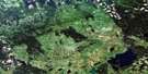
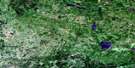
Renwer Satellite Image Map
Download Free Aerial Photo 063C02 at 1:50,000 scale
Renwer Satellite Imagery
To view this satellite map, mouse over the air photo on the right.
You can also download this satellite image map for free:
063C02 Renwer high-resolution satellite image map.
Maps for the Renwer aerial map sheet 063C02 at 1:50,000 scale are also available in these versions:
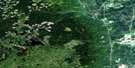
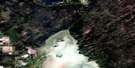
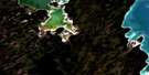
Renwer Surrounding Area Aerial Photo Maps
 |
 |
 |
 |
 |
 |
 |
 |
 |
 |
 |
 |
 |
 |
 |
 |
© Department of Natural Resources Canada. All rights reserved.
Renwer Gazetteer
The following places can be found on satellite image map 063C02 Renwer:
Renwer Satellite Image: Hydraulic construction
Cox DrainFarden Drain
Jarosz Drain
Old Government Drain
Swinowski Drain
Townline Drain
Renwer Satellite Image: Lakes
Eden LakesSinclair Lakes
Spence Lake
Whitesands Lake
Renwer Satellite Image: Mountains
Ikes HillRenwer Satellite Image: Other municipal/district area - miscellaneous
MinitonasMountain
Renwer Satellite Image: Conservation areas
Cowan Bog Ecological ReserveDuck Mountain Wildlife Refuge
Swan-Pelican Provincial Forest
Swan-Pelican Wildlife Refuge
Renwer Satellite Image: Rivers
Cowan CreekDuck River
Godin Creek
Little Duck River
Lost Creek
North Duck River
Pelican River
Sinclair River
Swan River
West Duck River
Wowchuk Creek
Renwer Satellite Image: Unincorporated areas
Briggs SpurCowan
Renwer
© Department of Natural Resources Canada. All rights reserved.
063C Related Maps:
063C Swan Lake063C01 Duck Bay
063C02 Renwer
063C03 Swan River
063C04 Thunder Hill
063C05 Townsend Lake
063C06 Birch River
063C07 Lenswood
063C08 Magnolia Lake
063C09 Kircro Lake
063C10 Pelican Rapids
063C11 Mafeking
063C12 Armit Lake
063C13 Roscoe
063C14 Barrows
063C15 Dawson Bay
063C16 Pelican Bay
