Palmerston Topo Map Online
Download Free Topo Map Sheet 040P15 at 1:50,000 scale
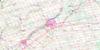
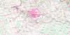
040P15 Palmerston Topo Map
To view this map, mouse over the map preview on the right.
You can also download this topo map for free:
040P15 Palmerston high-resolution topo map image.
Maps for the Palmerston topo map sheet 040P15 at 1:50,000 scale are also available in these versions:
Palmerston Surrounding Area Topo Maps
 |
 |
 |
 |
 |
 |
 |
 |
 |
 |
 |
 |
 |
 |
 |
 |
© Department of Natural Resources Canada. All rights reserved.
Palmerston Gazetteer
The following places can be found on topographic map sheet 040P15 Palmerston:
Palmerston Topo Map: Geographical areas
ArthurBruce
Carrick
East Garafraxa
East Luther
Egremont
Elma
Garafraxa
Grey
Howick
Huron
Luther
Maryborough
Minto
Normanby
Peel
Perth
Proton
Wallace
Wellington
West Garafraxa
West Luther
Palmerston Topo Map: Lakes
Ballinafad LakePike Lake
Palmerston Topo Map: Major municipal/district area - major agglomerations
BruceGrey
Huron
Perth
Wellington
Palmerston Topo Map: Other municipal/district area - miscellaneous
ArthurBentinck
Carrick
Culross
Egremont
Egremont
Elma
Glenelg
Howick
Luther
Mapleton
Mapleton
Maryborough
Mildmay-Carrick
Mount Forest/Arthur/West Luther/Arthur
Nichol
Normanby
Peel
Pilkington
Proton
South Bruce
Southgate
Teeswater-Culross
Wallace
Wellington North
West Garafraxa
West Garafraxa
West Grey
West Luther
Palmerston Topo Map: Rivers
Bethel CreekBrandy Creek
Conestogo River
Coon Creek
Fairbanks Creek
Farleys Creek
Four Mile Creek
Little Maitland River
Maitland River
Mallet River
Meux Creek
Middle Maitland River
Mitchell's Creek
Red Creek
Smoky Creek
South Saugeen River
Palmerston Topo Map: Towns
MintoNorth Perth
Palmerston Topo Map: Unincorporated areas
ArthurBosworth
Brotherston
Clare
Clifford
Conn
Cotswold
Derrynane
Drayton
Drew
Dryden
Farewell
Fultons
Glenlee
Gordonville
Gowanstown
Harriston
Harriston Junction
Kenilworth
Kurtzville
Melgund
Minto
Moorefield
Mount Forest
Newbridge
Olivet
Palmerston
Parker
Petherton
Redgrave
Riverbank
Riverstown
Rothsay
Shipley
Smithhurst
Stonywood
Teviotdale
Trecastle
Wagram
Wallace
Whites Junction
Palmerston Topo Map: Valleys
Smoky Hollow
© Department of Natural Resources Canada. All rights reserved.
