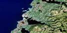
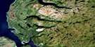
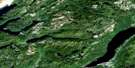
Cormack Satellite Image Map
Download Free Aerial Photo 012H06 at 1:50,000 scale
Cormack Satellite Imagery
To view this satellite map, mouse over the air photo on the right.
You can also download this satellite image map for free:
012H06 Cormack high-resolution satellite image map.
Maps for the Cormack aerial map sheet 012H06 at 1:50,000 scale are also available in these versions:
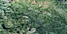
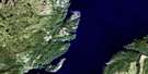
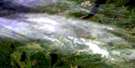
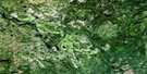
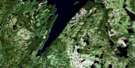
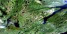
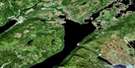
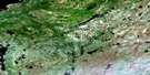
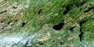
Cormack Surrounding Area Aerial Photo Maps
 |
 |
 |
 |
 |
 |
 |
 |
 |
 |
 |
 |
 |
 |
 |
 |
© Department of Natural Resources Canada. All rights reserved.
Cormack Gazetteer
The following places can be found on satellite image map 012H06 Cormack:
Cormack Satellite Image: Capes
Dancing PointMistaken Point
Cormack Satellite Image: Channels
Neds SteadyCormack Satellite Image: Falls
Big FallsLittle Falls
Cormack Satellite Image: Lakes
Adies PondAlder Pond
Balls Pond
Big Falls Pond
Canoe Pond
Coronation Pond
Diamond Pond
East Branch Pond
Extreme Pond
George VI Pond
Harrimans Steady
Hen Pond
Jones Pond
Kidney Pond
Long Pond
Lynx Pond
Massens Pond
McIsaacs Twin Ponds
Old Mans Pond
Otter Pond
Owl Pond
Sandy Lake
Sawmill Pond
Smelt Pond
Turners Pond
Two-Dam Pond
Upper Long Pond
Upper Pond
Wolf Pond
Cormack Satellite Image: Mountains
Birchy RidgeLong Range Mountains
Cormack Satellite Image: Conservation areas
Gros Morne National Park of CanadaParc national du Canada du Gros-Morne
Sir Richard Squires Memorial Provincial Park
Cormack Satellite Image: Rivers
Adies RiverAlder Brook
Bakers Brook
Beaver Brook
Big Falls Brook
Birchy Hill Brook
Black Brook
Boot Brook
Bottom Brook
Bridgers Brook
Crooked Feeder
Deadwater Brook
Drill Hole Brook
East Adies River
East Branch
East Branch
East Branch
First Branch
Flights Brook
Harrimans Brook
Joes Brook
Little Falls Brook
Mary Ann Brook
McIsaacs Brook
Middle Branch
Moose Brook
Ninety Brook
Northeast Adies River
Pratts Brook
Rocky Brook
Trout Brook
Upper Humber River
West Branch
West Branch
White Hill Brook
White Spruce Brook
Whites River
Wigwam Brook
Cormack Satellite Image: River features
Ox BowCormack Satellite Image: Shoals
Bear ReefCormack Satellite Image: Towns
CormackReidville
© Department of Natural Resources Canada. All rights reserved.
012H Related Maps:
012H Sandy Lake012H01 Dawes Pond
012H02 The Topsails
012H03 Deer Lake
012H04 Pasadena
012H05 Lomond
012H06 Cormack
012H07 Sheffield Lake
012H08 Springdale
012H09 King's Point
012H10 Hampden
012H11 Silver Mountain
012H12 Gros Morne
012H13 St Pauls Inlet
012H14 Main River
012H15 Jackson's Arm
012H16 Baie Verte
