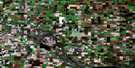
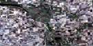
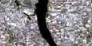
Punnichy Satellite Image Map
Download Free Aerial Photo 072P08 at 1:50,000 scale
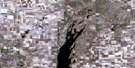
Punnichy Satellite Imagery
To view this satellite map, mouse over the air photo on the right.
You can also download this satellite image map for free:
072P08 Punnichy high-resolution satellite image map.
Maps for the Punnichy aerial map sheet 072P08 at 1:50,000 scale are also available in these versions:
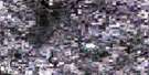
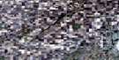
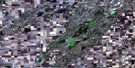
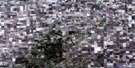
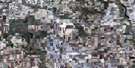
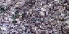
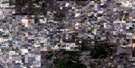
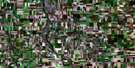
Punnichy Surrounding Area Aerial Photo Maps
 |
 |
 |
 |
 |
 |
 |
 |
 |
 |
 |
 |
 |
 |
 |
 |
© Department of Natural Resources Canada. All rights reserved.
Punnichy Gazetteer
The following places can be found on satellite image map 072P08 Punnichy:
Punnichy Satellite Image: Indian Reserves
Gordon 86Kawacatoose First Nation 88
Muskowekwan 85
Muskowekwan 85-11
Muskowekwan 85-13
Muskowekwan 85-14
Muskowekwan 85-15
Muskowekwan 85-16
Muskowekwan 85-18
Muskowekwan 85-25
Muskowekwan 85-3
Muskowekwan 85-30
Muskowekwan 85-32
Muskowekwan 85-34
Muskowekwan 85-35
Muskowekwan 85-4
Muskowekwan 85-40
Muskowekwan 85-42
Muskowekwan 85-44
Muskowekwan 85-5
Muskowekwan 85-52
Muskowekwan 85-53
Muskowekwan 85-6
Muskowekwan 85-7
Muskowekwan 85-9
Muskowekwan 85A
Poorman 88
Punnichy Satellite Image: Lakes
Big Fort LakeBittern Lake
Browns Lake
Doctor Lake
Hallis Lake
Heubach Lake
Hudson Bay Lake
Kawakatoos Lake
Kelly Lake
Kutawa Lake
Little Fort Lake
Loon Creek Lake
McNab Lake
Michel Lake
Mission Lake
Muscowequan Lake
Neiber Lake
Oochoo Lake
Pattison Lake
Pelletier Lake
Perry Lake
Pinacie Lake
Posthumus Lake
Pratt Lake
Reserve Lake
Seer Lake
Spafford Lake
Touchwood Lake
Wolf Lake
Yonkman Lake
Punnichy Satellite Image: Mountains
Beaver HillsLittle Touchwood Hills
Touchwood Hills
Punnichy Satellite Image: Other municipal/district area - miscellaneous
Emerald No. 277Kellross No. 247
Kutawa No. 278
Mount Hope No. 279
Touchwood No. 248
Punnichy Satellite Image: Conservation areas
Touchwood Hills Post Provincial Historic ParkTouchwood Hills Post Provincial Park
Touchwood Hills Provincial Historic Park
Touchwood Hills Provincial Recreation Site
Punnichy Satellite Image: Plains
Touchwood UplandsPunnichy Satellite Image: Rivers
West Loon CreekPunnichy Satellite Image: Unincorporated areas
KutawaTouchwood
Punnichy Satellite Image: Low vegetation
Strangs SloughPunnichy Satellite Image: Villages
PunnichyQuinton

© Department of Natural Resources Canada. All rights reserved.
