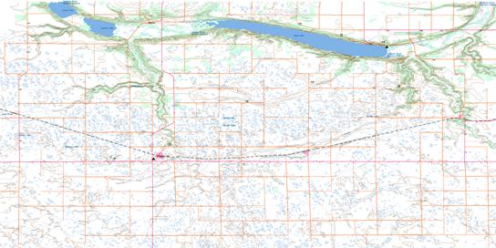
062G03 Holmfield Topo Map
To view this map, mouse over the map preview on the right.
You can also download this topo map for free:
062G03 Holmfield high-resolution topo map image.
Maps for the Holmfield topo map sheet 062G03 at 1:50,000 scale are also available in these versions:
Holmfield Surrounding Area Topo Maps
© Department of Natural Resources Canada. All rights reserved.
Holmfield Gazetteer
The following places can be found on topographic map sheet 062G03 Holmfield:
Holmfield Topo Map: Capes
Old Mill PointHolmfield Topo Map: Hydraulic construction
Rock Lake DamHolmfield Topo Map: Lakes
Chain PondsGimby Lake
Graves Lake
Haight Lake
Lorne Lake
Louise Lake
Mooneys Lake
Rock Lake
Silver Lake
Holmfield Topo Map: Mountains
The HogsbackHolmfield Topo Map: Other municipal/district area - miscellaneous
ArgyleLouise
Roblin
Strathcona
Holmfield Topo Map: Conservation areas
Holmfield Wildlife Management AreaRock Lake Game Bird Refuge
Rock Lake Provincial Recreation Park
Holmfield Topo Map: Provinces
ManitobaHolmfield Topo Map: Rivers
Badger CreekCrystal Creek
Cypress Creek
Gimby Creek
Long River
Long River
Marringhurst Creek
McGillis Creek
Old Mill Creek
Pembina River
Pilot Creek
Rivière Pembina
Whitemud Creek
Holmfield Topo Map: Road features
Boundary Commission - N.W.M.P. RouteParks Route
Route des parcs
Holmfield Topo Map: Springs
Averys SpringCavers Spring
Gillis Spring
Lukeys Spring
McElroy Spring
Holmfield Topo Map: Unincorporated areas
ClearwaterGlenora
Holmfield
Louise
Mather
Neelin
Holmfield Topo Map: Valleys
Bear HollowKellys Ravine
Pembina Valley
Holmfield Topo Map: Low vegetation
Cantlons SloughClarks Slough
Howard Slough
Olson Slough
Sinkers Slough
Stony Slough
Holmfield Topo Map: Villages
Cartwright© Department of Natural Resources Canada. All rights reserved.


