Brandon Topo Map Online
Download Free Topo Map Sheet 062G13 at 1:50,000 scale
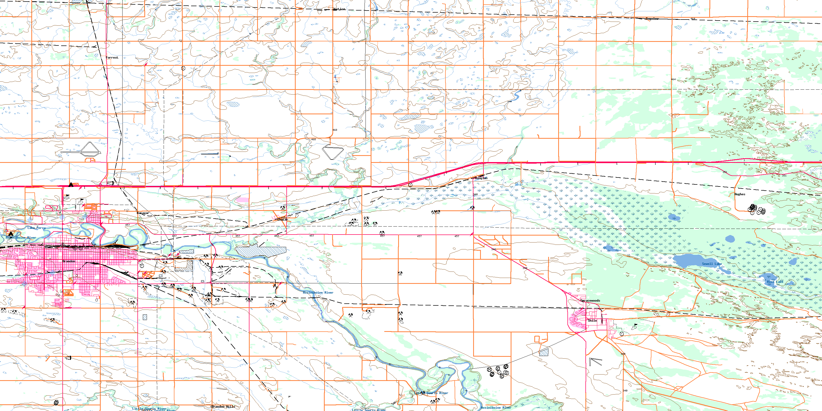
062G13 Brandon Topo Map
To view this map, mouse over the map preview on the right.
You can also download this topo map for free:
062G13 Brandon high-resolution topo map image.
Maps for the Brandon topo map sheet 062G13 at 1:50,000 scale are also available in these versions:
Brandon Surrounding Area Topo Maps
 |
 |
 |
 |
 |
 |
 |
 |
 |
 |
 |
 |
 |
 |
 |
 |
© Department of Natural Resources Canada. All rights reserved.
Brandon Gazetteer
The following places can be found on topographic map sheet 062G13 Brandon:
Brandon Topo Map: City
BrandonBrandon Topo Map: Lakes
Lake PercyRice Lake
Sewell Lake
Brandon Topo Map: Military areas
Base des Forces canadiennes ShiloCanadian Forces Base Shilo
Champ de tir et champ de manoeuvre Shilo
Shilo Range and Training Area
Brandon Topo Map: Other municipal/district area - miscellaneous
CornwallisElton
North Cypress
South Cypress
Brandon Topo Map: Conservation areas
Spruce Woods Provincial ForestSpruce Woods Provincial Park
Spruce Woods Wildlife Refuge
Brandon Topo Map: Rivers
Assiniboine RiverBoggy Creek
Boggy Creek
East Branch Willow Creek
Epinette Creek
Little Souris River
South Boggy Creek
West Branch Willow Creek
Willow Creek
Brandon Topo Map: River features
Charleston FordFiddlers Ford
Taylor Ford
Brandon Topo Map: Springs
Waggle SpringsWigle Springs
Brandon Topo Map: Unincorporated areas
Assiniboine GardensAssiniview Park
Baragar
Brandon Hills
Brandon North
Centennial
Chater
Cobfield
Cottonwoods
Douglas
Douglas Station
East End
East End Industrial Park
Forrest
Forrest Station
Glen Souris
Greenacres
Hamilton Heights
Highland Park
Hughes
Ingelow
Justice
Kirkcaldy Heights
Knox
Larkhill
Leon
Linden Lanes
Martinville
Meadows
Onah
Parkdale Heights
Richmond Park
Riverheights
Shilo
Sprucewoods
Trinity Park
Valleyview
Waverley
Westview
Wytonville
Brandon Topo Map: Low vegetation
Douglas MarshMathesons Slough
Stringer Slough
© Department of Natural Resources Canada. All rights reserved.
