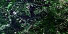
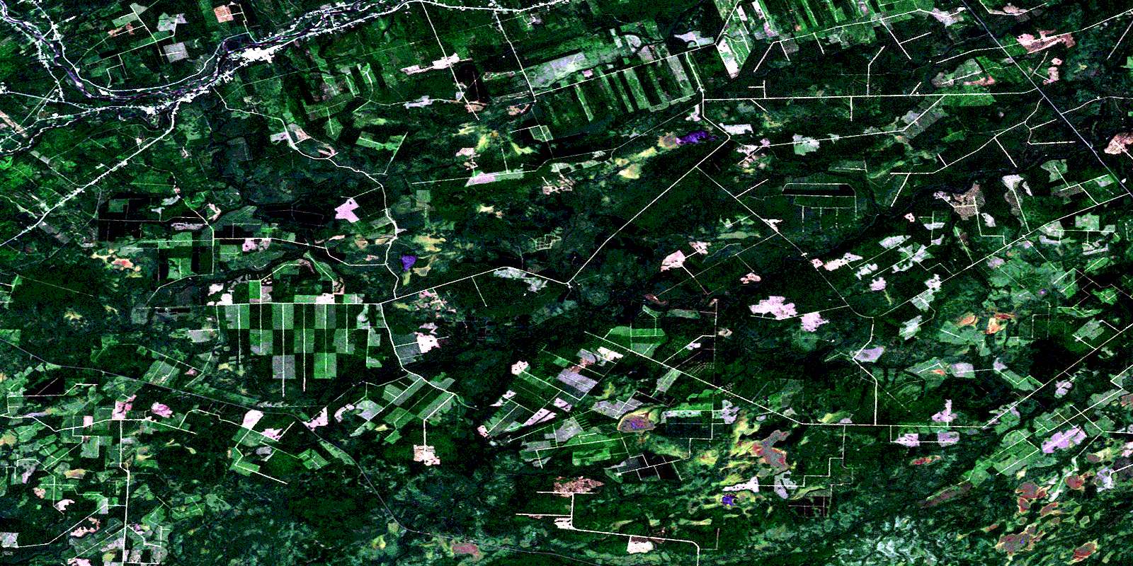
Boiestown Satellite Image Map
Download Free Aerial Photo 021J08 at 1:50,000 scale
Boiestown Satellite Imagery
To view this satellite map, mouse over the air photo on the right.
You can also download this satellite image map for free:
021J08 Boiestown high-resolution satellite image map.
Maps for the Boiestown aerial map sheet 021J08 at 1:50,000 scale are also available in these versions:
Boiestown Surrounding Area Aerial Photo Maps
 |
 |
 |
 |
 |
 |
 |
 |
 |
 |
 |
 |
 |
 |
 |
 |
© Department of Natural Resources Canada. All rights reserved.
Boiestown Gazetteer
The following places can be found on satellite image map 021J08 Boiestown:
Boiestown Satellite Image: Bays
Porter CoveBoiestown Satellite Image: Beaches
McCarty FlatsSand Plum Bar
Boiestown Satellite Image: Channels
Hovey ChannelBoiestown Satellite Image: Geographical areas
BlissfieldMaugerville
Northfield
Northumberland
Stanley
Sunbury
Boiestown Satellite Image: Islands
Boiestown IslandsBurnt Island
Clems Island
McCarty Island
Palmer Island
Portage Island
Portage Islands
Strongbow Island
Boiestown Satellite Image: Lakes
Burnt Land Brook LakeGaspereau Lake
Muzroll Lake
Boiestown Satellite Image: Plains
Duff PlainBoiestown Satellite Image: Rivers
Bantalor BrookBear Brook
Beaver Brook
Betts Mill Brook
Big Hollow Brook
Birch Brook
Blue Rock Brook
Brandy Brook
Burnt Land Brook
Cains River
Clearwater Brook
Conroy Brook
Dark Hollow Brook
Demmons Brook
Duff Brook
East Branch Burnt Land Brook
East Branch Gordon Brook
East Branch Lower Otter Brook
East Brook
Eldridge Brook
Estey Brook
Five Mile Brook
Flewelling Brook
Gaspereau River
Gordon Brook
Gordon Brook
Hickey Brook
Hinchey Brook
Langen Brook
Leighton Brook
Little Blue Rock Brook
Little South Branch Muzroll Brook
Lower Otter Brook
MacDonald Brook
MacDonald Brook
Mahoney Brook
Main Southwest Miramichi River
Mamies Brook
McCallum Brook
McCallum Brook
McCarty Brook
McCoy Brook
McKenzie Brook
McKinley Brook
Michigan Brook
Mountain Brook
Muzroll Brook
Muzroll Brook
North Branch Betts Mill Brook
North Branch Cains River
North Branch Muzroll Brook
North Cains River
North Muzroll Brook
Otter Brook
Palmer Brook
Pleasant Brook
Porter Brook
Sickle Brook
Slingdung Brook
South Branch Betts Mill Brook
South Branch Muzroll Brook
South Muzroll Brook
Southwest Miramichi River
Standish Brook
Stewarts Brook
Taxis Brook
Taxis River
Ten Mile Brook
Tenmile Brook
West Branch Burnt Land Brook
West Branch Gordon Brook
West Branch Lower Otter Brook
West Gordon Brook
Wildcat Brook
Willow Brook
Young Brook
Youngs Brook
Boiestown Satellite Image: River features
Dudleys BoganBoiestown Satellite Image: Unincorporated areas
AstleBantalor
Bettsburg
Bloomfield Ridge
Boiestown
Ludlow
New Bandon
North Cains
Porter Brook
Porter Cove
Taxis River
© Department of Natural Resources Canada. All rights reserved.
021J Related Maps:
021J Woodstock021J01 Minto
021J02 Burtts Corner
021J03 Millville
021J04 Woodstock
021J05 Florenceville
021J06 Coldstream
021J07 Napadogan
021J08 Boiestown
021J09 Doaktown
021J10 Hayesville
021J11 Juniper
021J12 Perth-Andover
021J13 Aroostook
021J14 Plaster Rock
021J15 Tuadook Lake
021J16 Mckendrick Lake
