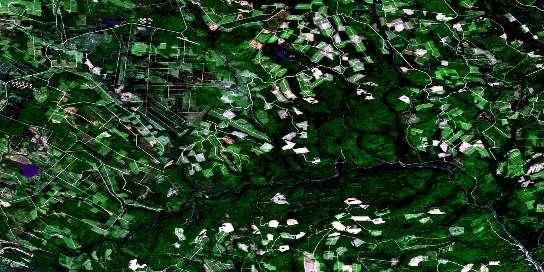
Hayesville Satellite Imagery
To view this satellite map, mouse over the air photo on the right.
You can also download this satellite image map for free:
021J10 Hayesville high-resolution satellite image map.
Maps for the Hayesville aerial map sheet 021J10 at 1:50,000 scale are also available in these versions:
Hayesville Surrounding Area Aerial Photo Maps
© Department of Natural Resources Canada. All rights reserved.
Hayesville Gazetteer
The following places can be found on satellite image map 021J10 Hayesville:
Hayesville Satellite Image: Beaches
Hayes BarSlate Island Bar
Hayesville Satellite Image: Falls
Burnt FallsBurnt Falls
Fall Brook Falls
Kettle Falls
Lambert Falls
Salmon Falls
Square Falls
Trout Brook Falls
Winding Falls
Hayesville Satellite Image: Geographical areas
DouglasSouthesk
Stanley
Hayesville Satellite Image: Hydraulic construction
Manzer DamYoung Dam
Hayesville Satellite Image: Islands
Birch IslandBirch Islands
Clearwater Island
Gaspereau Island
Grassy Island
Lower Birch Island
Palmer Island
Phoebe Island
Slate Island
Upper Birch Island
Hayesville Satellite Image: Lakes
Beaver Brook LakeBig Sister Lake
Blind Lake
Brown Lake
Carson Lake
Deadman Lake
Deadmans Lake
Deer Lake
Diamond Lake
East Branch Lake
Four Mile Lake
Gilman Lake
Harris Lake
Hayden Lake
Hurd Lake
Indian Village Lake
Little Sister Lake
Long Lake
Lower Lake
Lower Peaked Mountain Lake
McKiel Lake
Middle Lake
Middle Peaked Mountain Lake
Mud Lake
Peaked Mountain Lake
Peaked Mountain Lakes
Peeked Mountain Lakes
Peeked Mountain Lakes
Peeked Mountain Lakes
Round Lake
Salmon Brook Lake
Tahoe Lake
The Sisters Lakes
The Sisters Lakes
Three Mile Lake
Trout Lake
Upper Peaked Mountain Lake
Hayesville Satellite Image: Mountains
Gilman PeakLouie Mountain
Peaked Mountain
Sisters Mountain
Todd Mountain
Hayesville Satellite Image: Rapids
Burnthill RapidsCompany Line Rapids
Little Burnthill Rapids
Louie Rapids
Narrows Rapids
Push and Be Damned Rapids
Rocky Bend Rapids
Rocky Brook Rapids
Sisters Rapids
The Jaws
The Jaws
Three Mile Rapids
Hayesville Satellite Image: Rivers
Bamford BrookBear Brook
Beatty Brook
Beaver Brook
Birch Brook
Black Brook
Bruce Brook
Burnthill Brook
Buttermilk Brook
Buttermilk Brook
Carson Brook
Clearwater Brook
Clearwater Brook
Colepaugh Brook
Conroy Brook
Deadman Brook
Deadmans Brook
Deer Brook
Donnelly Brook
Dungarvon River
East Branch Salmon Brook
East Salmon Brook
Fall Brook
Fall Brook
Four Mile Brook
Fullerton Brook
Gilman Brook
Green Brook
Green Brook
Green Brook
Griffin Brook
Harris Brook
Hayes Brook
Hinman Branch
Hovey Brook
Joe Brook
Joe Brook
Lake Brook
Little Dungarvon River
Little Northwest Branch Dungarvon River
Little South Branch Burnthill Brook
Little South Burnthill Brook
Little South Burnthill Brook
Lower Hayden Brook
Luke Brook
Main Southwest Miramichi River
McBean Brook
McConnell Brook
McDonald Brook
McKiel Brook
McLean Brook
Middle Hayden Brook
Molasses Brook
Moose Brook
Nine Mile Brook
North Branch Burnthill Brook
North Branch of Burnt Hill Brook
North Burnthill Brook
Otter Brook
Pig Brook
Ranger Brook
Rocky Brook
Salmon Brook
Sand Brook
Sand Pond Brook
Ships Bows Brook
Sisters Brook
Slate Island Brook
Snake Brook
Snake Brook
South Branch Burnthill Brook
South Burnthill Brook
South Burnthill Brook
Southwest Miramichi River
Spider Brook
Sprague Brook
Spud Brook
Three Mile Brook
Tom McKiel Brook
Trout Brook
Two and a Half Mile Brook
Upper Buttermilk Brook
West Branch Lower Hayden Brook
West Lower Hayden Brook
Hayesville Satellite Image: River features
Burnthill ForksJohnson Crossing
McKiel Bogan
Price Bend
Seeley Bogan
Hayesville Satellite Image: Shoals
Rangers RocksHayesville Satellite Image: Unincorporated areas
HayesvilleTugtown
© Department of Natural Resources Canada. All rights reserved.
021J Related Maps:
021J Woodstock021J01 Minto
021J02 Burtts Corner
021J03 Millville
021J04 Woodstock
021J05 Florenceville
021J06 Coldstream
021J07 Napadogan
021J08 Boiestown
021J09 Doaktown
021J10 Hayesville
021J11 Juniper
021J12 Perth-Andover
021J13 Aroostook
021J14 Plaster Rock
021J15 Tuadook Lake
021J16 Mckendrick Lake


